
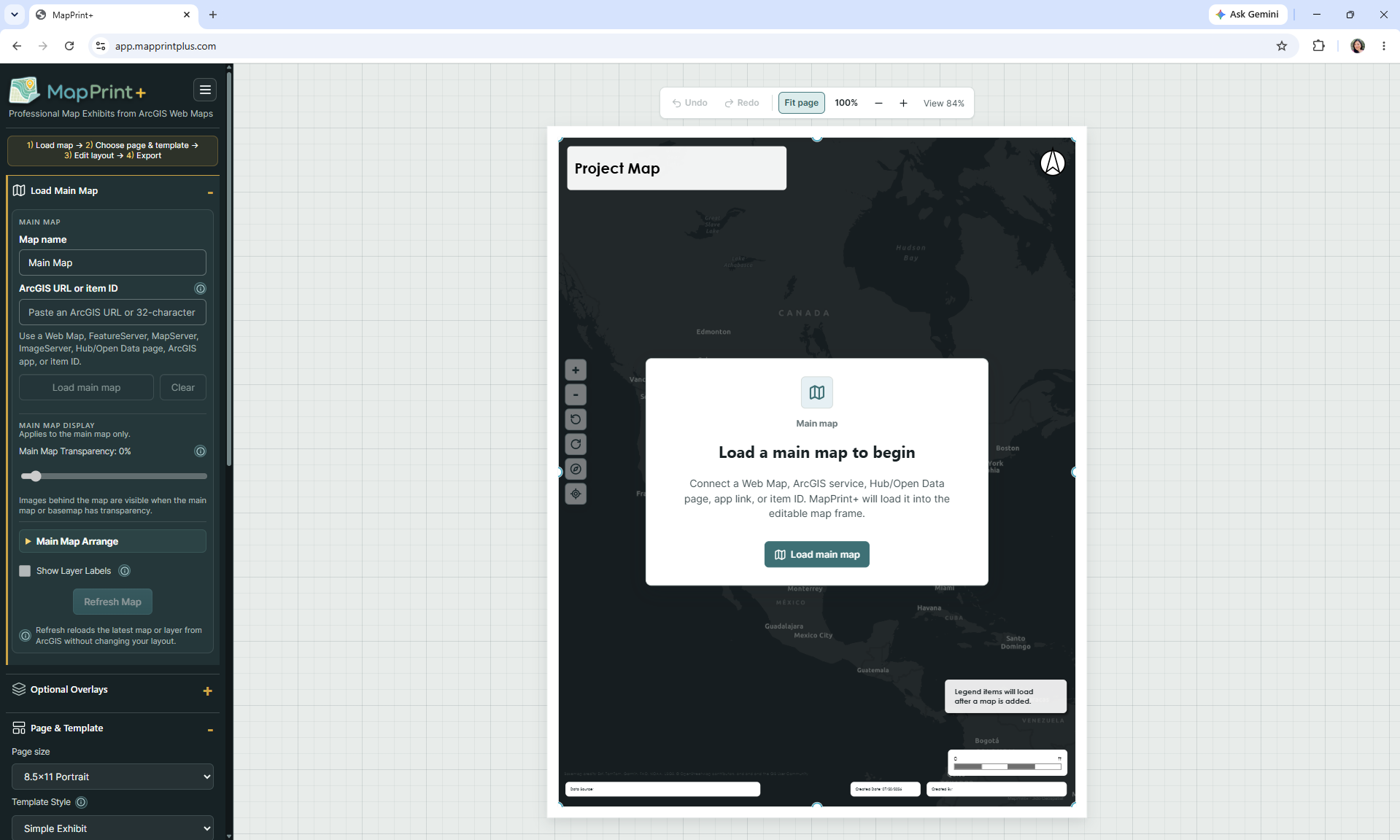
Connect content
Begin with a supported ArcGIS web map, item, service, app link, or open-data source.
Print-ready mapping, without starting over
MapPrint+ gives planners, consultants, and GIS teams a focused workspace for arranging existing ArcGIS content into clear, professional, print-ready layouts.
MapPrint+ is currently an invite-only beta. Requesting access does not create an account or guarantee approval.
Built to complement your GIS
MapPrint+ provides a focused workspace for turning existing web GIS content into polished map exhibits, after the editing and analysis work is already done.
Learn more about how MapPrint+ worksA focused workflow
Keep your governed web GIS content at the center of the work while adding the context and structure a professional exhibit needs.
Begin with a supported ArcGIS web map, item, service, app link, or open-data source.
Select a print-oriented template, orientation, and page size that fit the assignment.
Arrange titles, legends, notes, images, callouts, north arrows, scale bars, and more.
Produce a full layout or map-frame export for reports, meetings, review, and delivery.
Built for map communication
MapPrint+ is not another full GIS platform. It concentrates on the final communication layer: the page your team, client, council, or community needs to see.
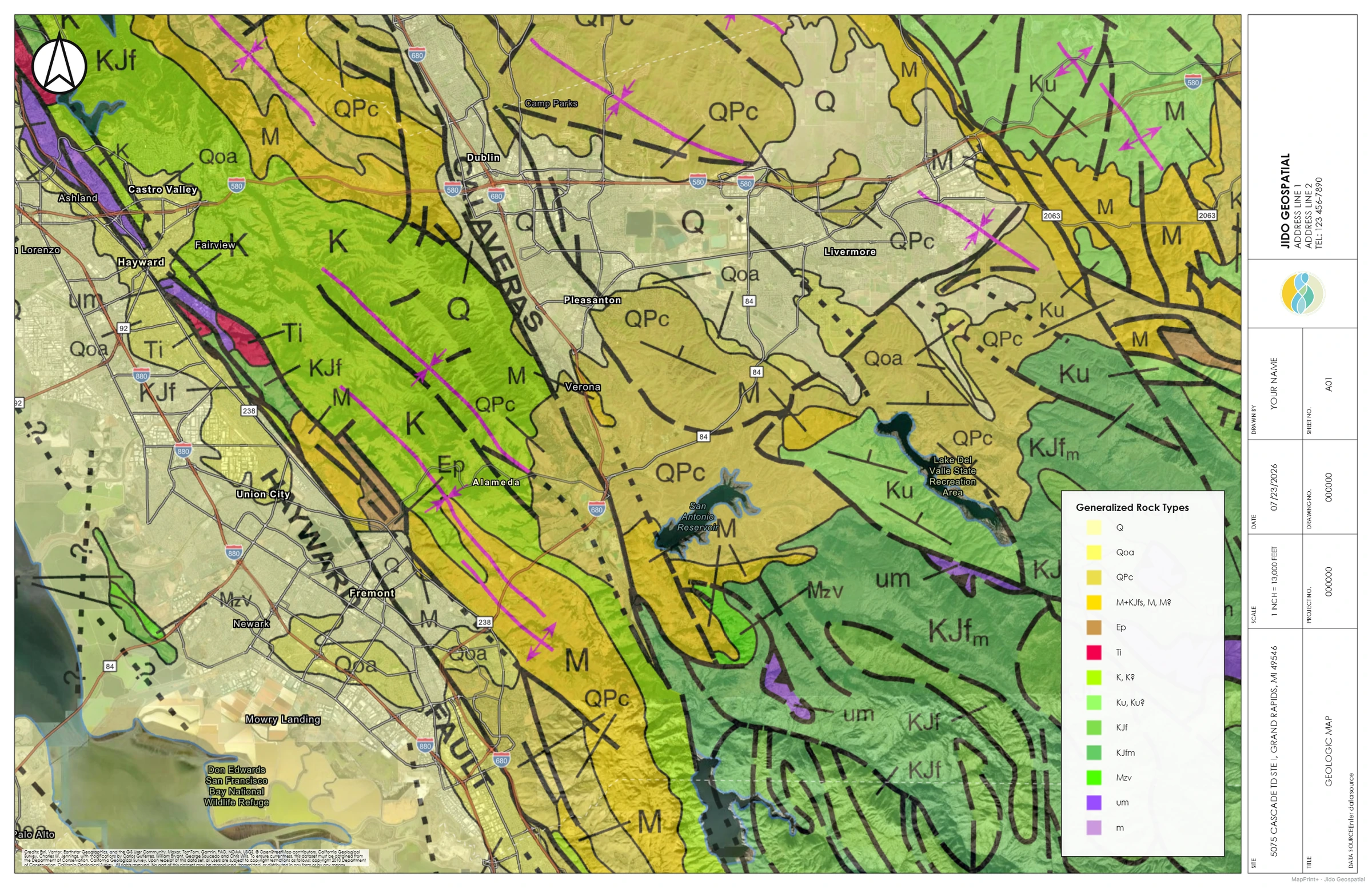 Geologic engineering exhibitA landscape map with a structured side panel for technical context.
Map output examples
Select an example to inspect the full-size output.
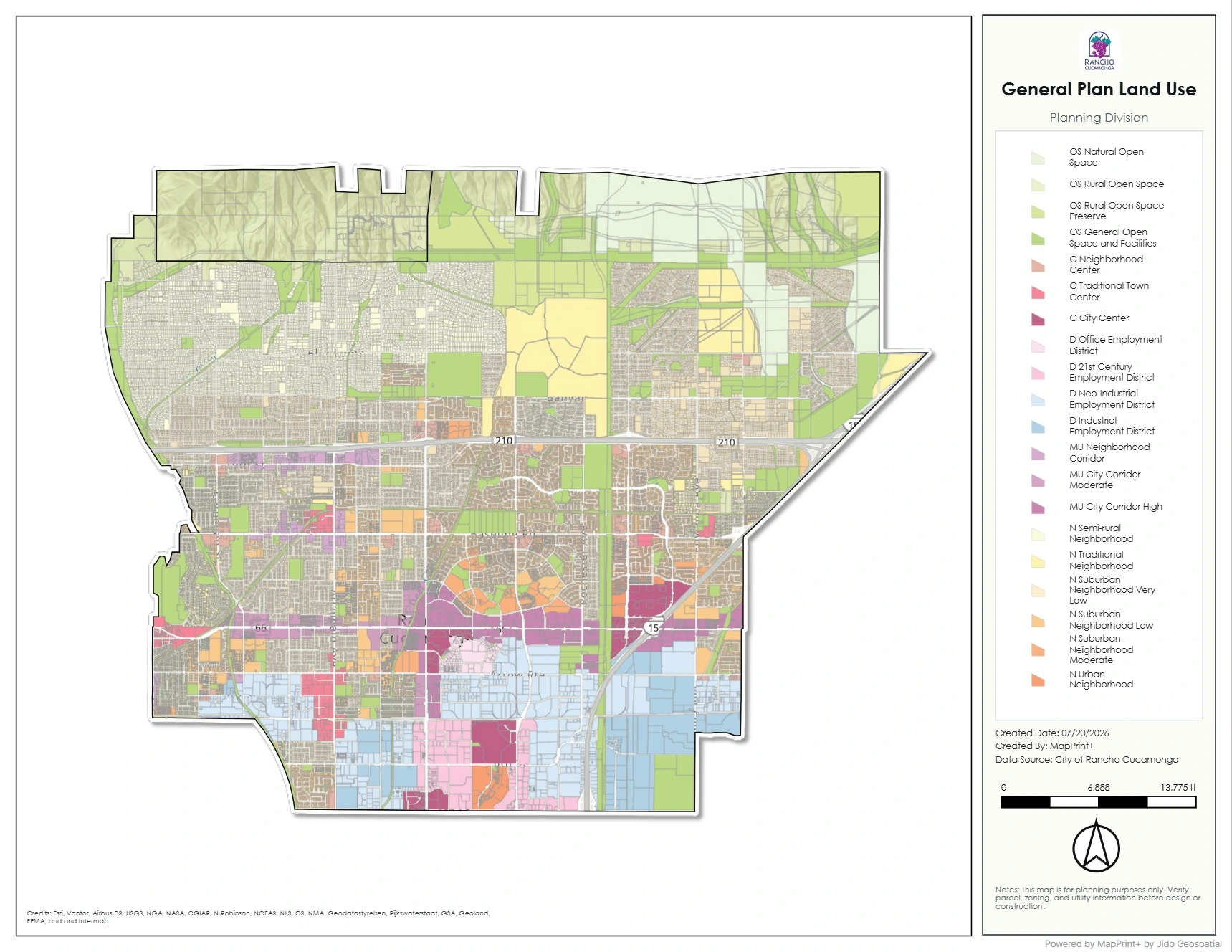 Planning side-panel exhibitA planning layout that balances the mapped area with supporting project information.
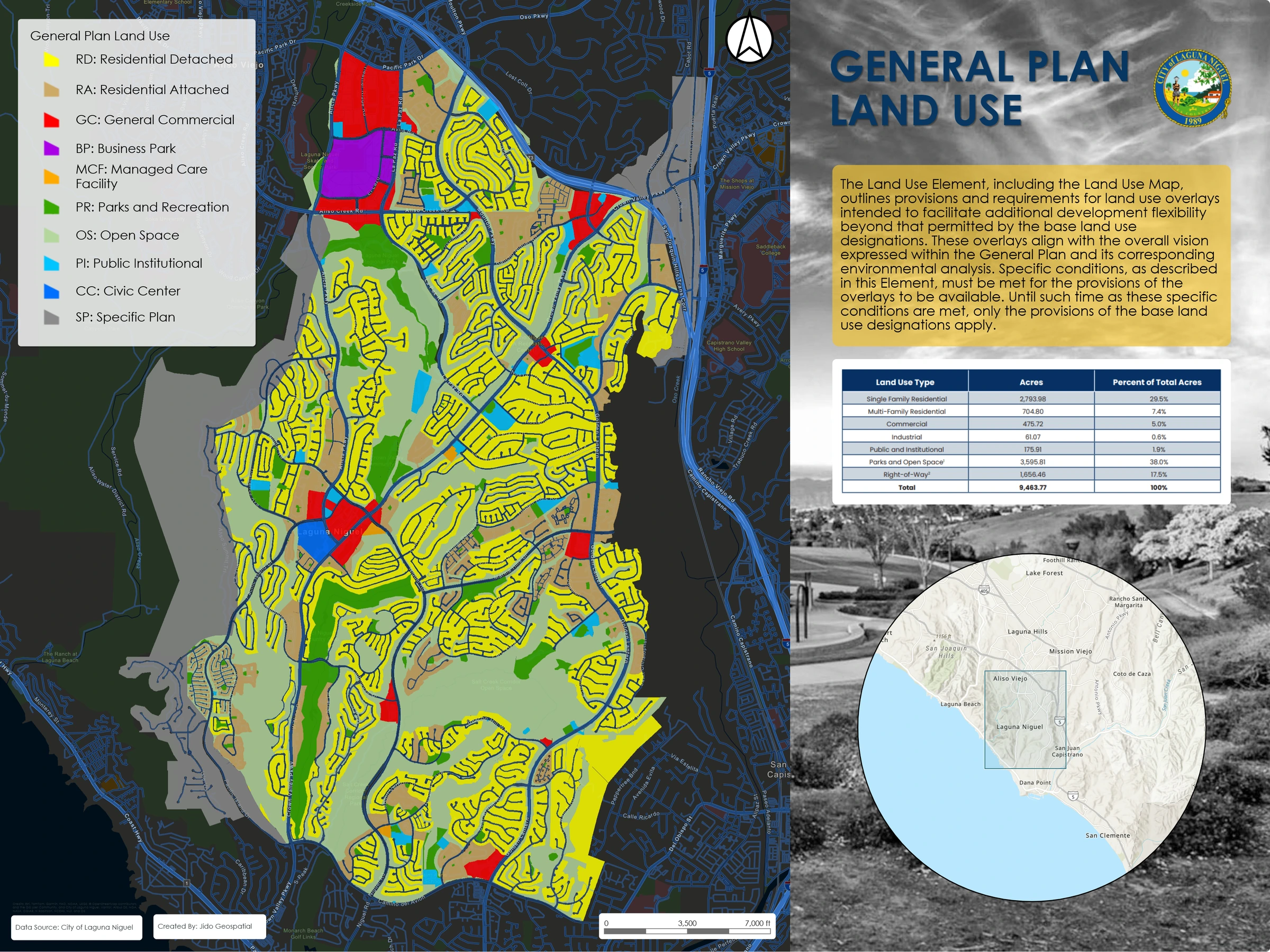 General plan land useA large-format land-use exhibit with clear categories and a strong legend hierarchy.
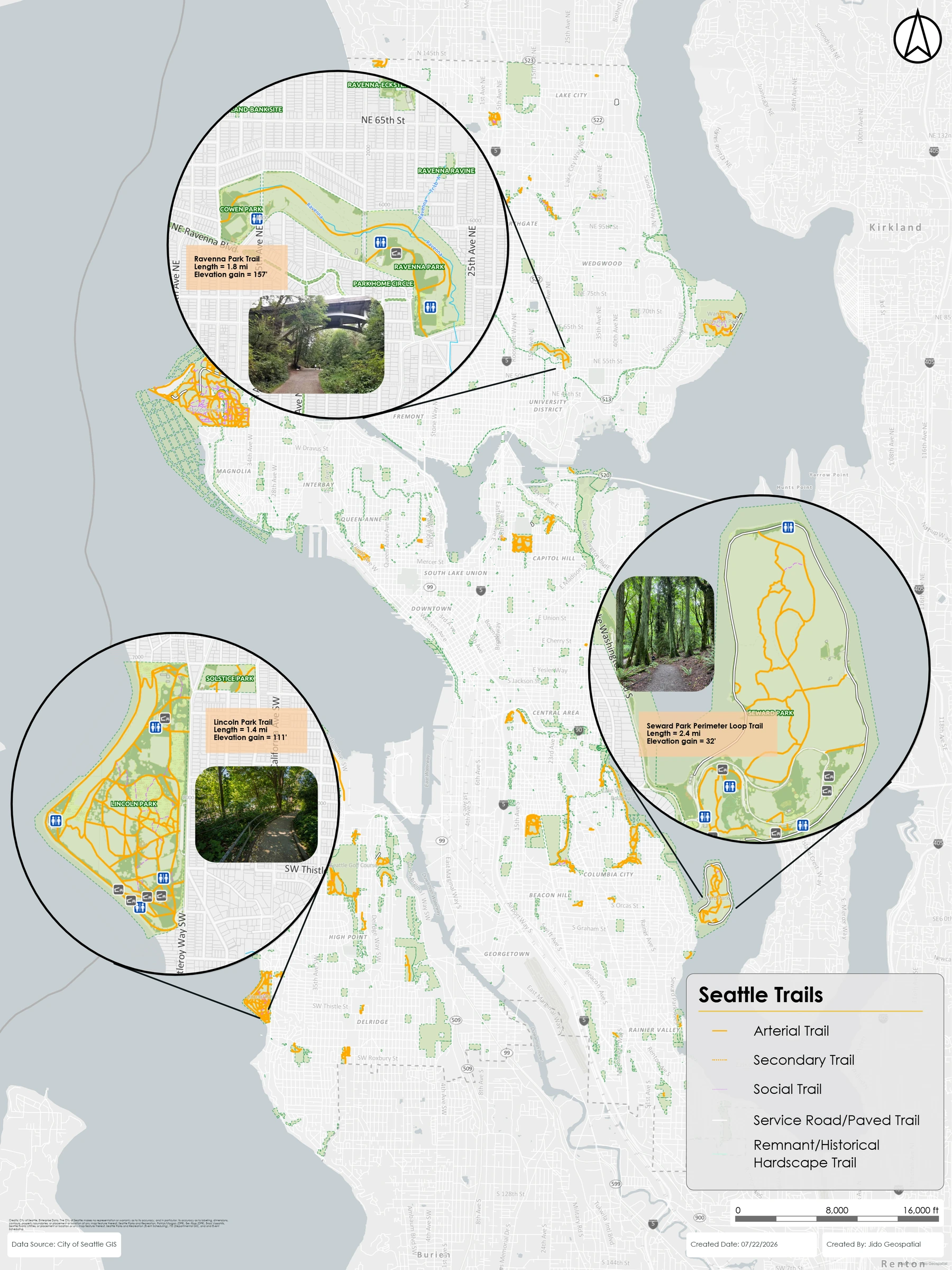 Seattle trailsA public-facing portrait map that emphasizes routes and geographic context.
Who it helps
Zoning, land-use, staff-report, and public-hearing exhibits.
Environmental, location, proposal, and project-delivery maps.
Infrastructure, engineering, grant, and community-meeting exhibits.
Repeatable layout help for colleagues who rely on managed web GIS.
Invite-only beta
We are inviting a limited group of ArcGIS users to test MapPrint+, share real layout needs, and help guide the product. A beta request is reviewed by the MapPrint+ team and never creates an account automatically.