
Build from existing GIS
Start from supported ArcGIS web maps, item IDs, services, app links, and selected open-data sources. Add feature, raster-tile, or vector-tile references where the workflow supports them.
Task-focused features
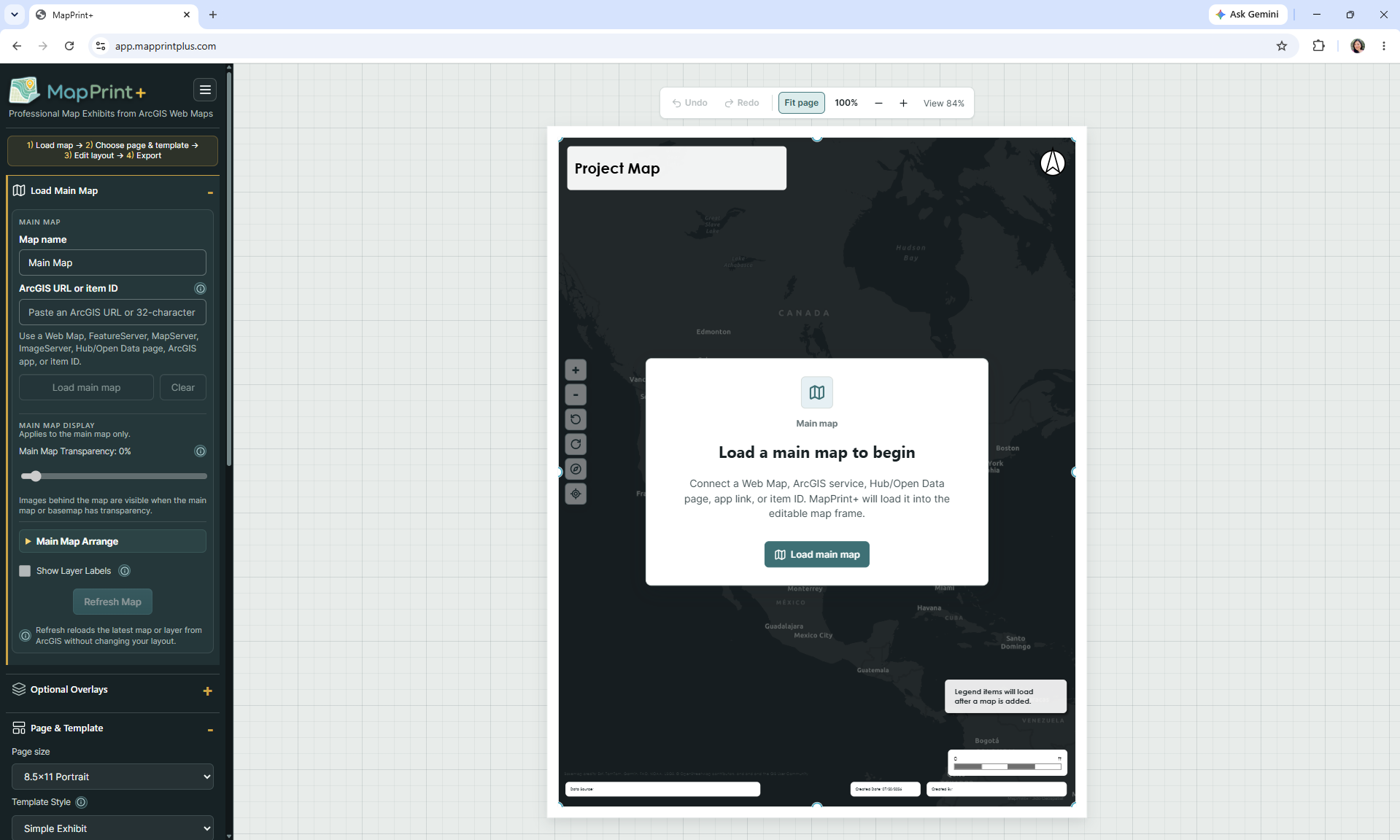
MapPrint+ brings source content, layout structure, annotations, map elements, and export controls into one print-focused workspace.
Start from supported ArcGIS web maps, item IDs, services, app links, and selected open-data sources. Add feature, raster-tile, or vector-tile references where the workflow supports them.
Use simple, planning, engineering, or side-panel templates across common letter, A-series, and larger exhibit sizes.
Set the extent and composition, then use insets or additional context to make the mapped subject clear.
Place and refine legends, north arrows, scale bars, titles, subtitles, credits, and metadata.
Add editable text, labels, callouts, images, tables, gridlines, and other supporting information around the map.
Export the full layout or map frame to PNG, JPEG, or PDF at supported resolutions, and save project files for later work.
Designed around the deliverable
MapPrint+ is intentionally narrower than a desktop GIS. It does not replace analysis, data editing, geoprocessing, or web-map administration. It picks up when the geographic content already exists and a clear, polished page is the next task.
Configured around your standards
Need MapPrint+ tailored to your organization? Agency-specific template configuration and selected workflow customization are available. This can include custom logos, title blocks, page layouts, disclaimers, preferred page sizes, default map elements, and other organization-specific requirements.
Organizations using ArcGIS Enterprise may also require a one-time Portal configuration for protected content.
Customization availability and pricing depend on scope.
Questions & answers
MapPrint+ picks up where your web GIS leaves off—helping you turn existing geographic content into polished, print-ready map exhibits.
No. MapPrint+ is a print-focused layout tool for creating polished map exhibits from existing web GIS content. It does not replace GIS software for data editing, spatial analysis, geoprocessing, database management, or building and maintaining GIS datasets. MapPrint+ is designed for the stage after your GIS content already exists and you need to turn it into a clear, professional map layout.
MapPrint+ is designed to work with existing web GIS content, such as ArcGIS web maps, supported hosted layers, item IDs, and supported map or feature services. It is not intended to create GIS data from scratch.
MapPrint+ is intended for planners, GIS staff, consultants, public works teams, local government staff, environmental professionals, and others who regularly need clean, professional map exhibits from existing GIS content.
Yes. MapPrint+ can work with authenticated ArcGIS content while keeping your MapPrint+ account and ArcGIS credentials separate. ArcGIS Online users sign in through ArcGIS when protected content requires access. Protected ArcGIS Enterprise content may require a one-time configuration for your organization's Portal before it can be used with MapPrint+. Contact us if your organization uses ArcGIS Enterprise and we can help with setup. Public ArcGIS content does not require this additional setup.
Examples include planning exhibits, project-location maps, land-use maps, engineering or public works exhibits, environmental maps, staff-report graphics, grant-application maps, and other print-oriented map layouts.
Yes. Custom template setup and selected organization-specific configurations are available for an additional fee. Examples include agency branding, standard title blocks, preferred page sizes, disclaimers, and approved map layouts. Contact us to discuss your requirements and availability. Organizations may also request configurations that prioritize or limit users to approved agency templates.
MapPrint+ is currently available through a limited, invite-only beta. Submit the Request Beta Access form on mapprintplus.com. Requests are reviewed manually, and approved users receive separate account and sign-in instructions. Submitting the form does not automatically create a MapPrint+ account.
MapPrint+ is designed to work with existing GIS content rather than replace or manage the source datasets. Your existing GIS remains the source for that content. Data handling can vary by supported workflow and service configuration, so review the current privacy information and access guidance before using protected or sensitive content.
Current access
Tell us about your ArcGIS environment, team, and primary map-output needs. Submitting a request starts a review; it does not create an account automatically.